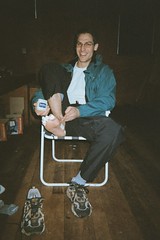
We proceeded to make up our breakfast. We shared one of the modern dried meals - a "cooked breakfast" - and then I had an additional plate of muesli. The cooked breakfast was surprisingly tasty, although it was a little salty. After breakfast we proceeded to tape our feet in preparation for the day. The picture at the right shows Kevin taping all of the toes on his right foot.
Kevin was a little worried about whether we were supposed to be in the woolshed so early. He needn't have worried - after we had been in there for about an hour, one of the organisers came in and said that she was really pleased to see the lights on, as she hadn't slept much since about 1am and was glad to have an excuse to get up.
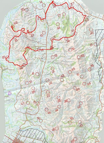
We received our maps at 6am and started to plot our course. Before long it was 7am and time to start. Along with about half of the other teams, we set off towards control 19 - only 10 points, but it seemed like a fairly obvious control to collect on the way out. At that control, teams scattered in all directions, and we headed on our own towards control 46. We followed an unmarked farm track up a gully rather than climbing the steep hill to the control, and then headed roughly SSE to reach the control. From there it was downhill to another farm road, whichwe followed uphill until it was time to turn SW towards control 84, located at a trig station.
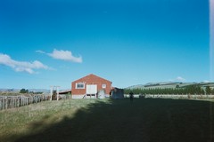
From control 84 we headed west down a spur that would take us towards control 85. It was here that we first met some of the locals. The cattle were determined to head in exactly the same direction that we wanted to go! We dropped down to a stream beside the spur and headed out to the river flat, and from there wenegotiated our way through the electric fences to control 85, which was located beside a farm shed.
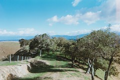
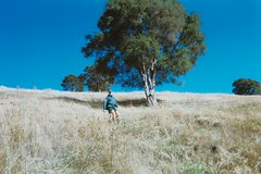
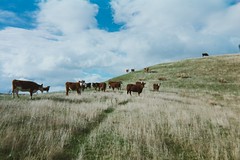 | 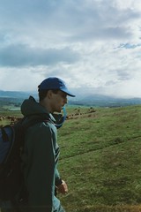 Above: Kevin drinking. Top left: some of the local residents. Left: trees on the ridge heading to Control 62. Bottom left: Kevin descending. |
 | |
 |
At this point we made our big route-planning mistake of the day. We headed up the hill towards control 18 (beside a pond), then headed around the top of a gully and all the way back down again to control 62 (stream junction). Having collected control 62, we then turned around and climbed all the way back up again to the top of the hill and headed down the other side towards control 47 (fence/stream junction). A much more sane strategy would have been to collect control 62 first, maybe collect control 18 when we were at the top of the hill, and then proceed to control 47.
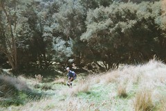 Me descending to the stream leading to Control 62. | 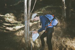 Me clipping Control 62. |
Control 47 proved a little difficult to find - not because it was in a difficult place, but simply because we mis-judged distance travelled. We thought we had travelled further than we really had, and ended up wondering why we had missed the control. In the end we climbed to the top of a nearby hill to re-orient ourselves. We eventually found the control and then continued further downstream to find a sunny spot for lunch. Lunch was another modern dried meal: yoghurt and muesli with apples, all reconstituted with cold water. Another miracle of modern technology - it tasted great!
From Control 47 it was a relatively straightforward journey to Control 27 (fence junction), then up the road to Control 28 (woolshed). From Control 28, we followed a farm track around to near Control 37. From Control 37 it was across a paddock, over a fence, and along a creek until we were close to Control 63. As we were approaching Control 63 we started to meet a lot of other people who were doing the shorter course options. Our navigation was spot on, and we managed to find the control pretty well straight away.
From Control 63 we headed up the steep sides of a gully in the general direction of Control 61 (old water tank). The terrain in this area was very steep and we may not havechosen the best route. As we got close to a farm road that would lead to the water tank, we saw a concrete water tank next to the road in the distance. We headed straight for the water tank, only to find it was not the one that wewere after. We were still heading in the right direction, and were now on an easy road rather than traversing steep hills. We went up the road and then followed a stream until we reached the control - an old corrugated iron water tank.
It was starting to get dark and cold by this point, so we stopped to put on some extra clothing and put on our headlamps. Our next stop was Control 26, but before we could get there we had to climb a saddle in front of us. I was starting to feel quite tired by now, so I ate an energy gel on the way up. At the top of the saddle we emerged back in to the strong, cold wind. We stopped so that Kevin could put on his windproof pants. I was already wearing my long johns (and had done so all day), and they were generally warm enough. We sidled around a stand of bush and down a fence line to reach the pond where Control 26 was located.
From here it all looked pretty straight forward - just follow a compass bearing until we hit a fence perpendicular to our path, then turn left and walk along the fence until coming to a stream, which was where Control 11 should be. Then it was just a case of keeping going straight ahead to the woolshed. Barely a couple of hundred metres from Control 26 and it all started to go wrong. First, we found a fence at completely the wrong angle, then we found a stream where we didn't expect to find one. It was completely unclear where exactly we were, and we tried a few very hilly diversions to see if they offered a more promising way home. A glance at the lights bobbing down the hill behind us told us that we were right to follow the stream, but we had no idea where we would end up. Finally we reached the fence … the stream we were following intersected the fence, and there was Control 11. From there it was a straight line across recently ploughed ground to reach the woolshed and the finish.
Lessons:
- Check, double-check, and triple-check the intended route.
- Never climb to get a low-value control, descend to get a high value control, and then climb back up again when one climb would be sufficient!
- When already high, stay high for as long as possible.
- "Gut feel" navigation can work in open country until fatigue sets in. After that (or in the dark or in bush), the compass is essential.
- Check the map very very carefully at night. After the event we found that the stream leading to Control 11 was clearly marked on the map. Whether through tiredness, poor light, or carelessness in our hurry to get home, we had missed it when we checked the map out on the course.
0 comments:
Post a Comment