As something of a regional tour, Mal Law from Running Wild kindly organised a night of trail running movies in various centres around New Zealand. The centre-piece of the night was the official film documentary on the "Dragon's Back Race", a 5-day mountain-marathon style race along the mountainous spine of Wales.
The mountain marathon format is not well known in New Zealand, with participants able to choose any route they like between check points (typically located on strategic summits). The closest we have is rogaines, and certainly the competitors that we meet in the film remind me a lot of the type of people drawn to long distance rogaining in New Zealand.
Inspiring stuff, and certainly had me thinking that I must do more rogaines, and also got me thinking (again) about the possibility of doing the Northburn 100 - very similar terrain to parts of the Dragon's Back. We shall see...
Here official trailer for the film:
The film itself can be ordered from the event website.
UK Trail Running magazine also had extensive coverage of the 2012 race, and their video footage is also available in the films section of the event website.
Showing posts with label Rogaine. Show all posts
Showing posts with label Rogaine. Show all posts
Monday, July 29, 2013


Monday, February 6, 2012
Belmont Rogaine
The last of the 5 events held in Wellington over Waitangi weekend to celebrate the 21st birthday of rogaining in New Zealand. The very first New Zealand rogaine was held in Belmont Regional Park, and today's 4 hour event was also held in the park.
With about 10-15 minutes of planning we had picked a loop, and then walked back to the start area just in time to miss most of the briefing! A couple more minutes and then it was time to start.
 We initially set off at a jog, making sure we really were where we thought we were on the map. Cross-country along a fence line for a short section, then up a steep hill to gain our first points at the trig. Just 10 points, but we were underway!
The next control looked easy on the map, but for some reason we didn't find it quite as fast as might have been expected... which in this instance just means we had to search a little rather than walking straight to it.
On to the next one, down the hill, up the next one to the track junction, and ... stop. In a demonstration of just how out of practice we were with map reading and rogaining, both of us jumped to the conclusion that the next control must be over the far side of the huge hill in front of us. After several minutes of matching features to the map, and actually reading the map properly, we realised that the next control was DOWN the slope in front of us, just a few hundred metres away. So down we went, and control #90 was in the bag.


 We continued down hill to the farm road at the bottom of the valley, and continued on with our planned route of heading out to pick up #41. That done, it was back up the valley, and then a steep climb out to get #52. Another short, steep climb and we were back level with the WWII bunkers. Count the pillars inside one of the bunkers for another 20 points - not such a fun task when there were several dead sheep inside!
 Then off for a jog as we set off to get #50 at a power pylon. We now decided to make a change to our plan, and rather than heading to #80 and then #51, we instead went to #70 then down to #80. This route to #70took us around a track not far below a trig... the trig wasn't a control, but it was there... and we might not ever be here again... so we climbed the short distance up the hill to claim a gratuitous trig!
Trig conquered, it was off to #70. Climbing over a gate, I jumped down and felt a searing pain in the main joint of my right big toe... this was not good! No more running for a while, and even walking I was a bit slow. When we got home there was a large bruise on the side of my foot, so somehow I had landed badly and caused some damage.
 We claimed #70, down the steep hill to the farm track, then walked and jogged down to the valley floor. Up to #80 - quite a social control with lots of people claiming it. Along to #51 or climb out the more direct way? We decided we were getting tired and didn't want to have to sprint uphill to the finish! So we climbed out the direct way, and then claimed controls #12 and #11 and had a more leisurely finish.
With about 10-15 minutes of planning we had picked a loop, and then walked back to the start area just in time to miss most of the briefing! A couple more minutes and then it was time to start.

Competitors scaling the hill to the first trig.
The next control looked easy on the map, but for some reason we didn't find it quite as fast as might have been expected... which in this instance just means we had to search a little rather than walking straight to it.
On to the next one, down the hill, up the next one to the track junction, and ... stop. In a demonstration of just how out of practice we were with map reading and rogaining, both of us jumped to the conclusion that the next control must be over the far side of the huge hill in front of us. After several minutes of matching features to the map, and actually reading the map properly, we realised that the next control was DOWN the slope in front of us, just a few hundred metres away. So down we went, and control #90 was in the bag.

Looking down into the gully concealing #90


A row of World War II bunkers in the distance.

At the gratuitous trig
Trig conquered, it was off to #70. Climbing over a gate, I jumped down and felt a searing pain in the main joint of my right big toe... this was not good! No more running for a while, and even walking I was a bit slow. When we got home there was a large bruise on the side of my foot, so somehow I had landed badly and caused some damage.

Rogainers in the valley below
Thursday, July 14, 2011
Eastbourne Rogaine

We set off through the streets to collect a couple of 10 pointers and 20 pointers, a good opportunity to warm up on the flats before heading into the hills. A rude shock as we started up the short but steep climb up to #42, then up a much bigger climb to find #80.
At the top of the climb we headed south along a track that initially we doubted even existed. But then the vegetation opened up and we followed it through one open stand of beech trees, another section of dense vegetation, a second stand of beech trees... and couldn't find the control anywhere. After going a long way past where the control should be and coming all the way back again. We saw several other teams up there, but no one could find the control! Eventually we decided that was enough time wasted and we should head on to the next control.
Out to the main track and along to #34. A long haul, with a much steeper and more techical (lots of tree roots) climb than anticipated up to #35. Yet more climb and roots as we made our way up to #51. That took a little bit of hunting for, but not too much.

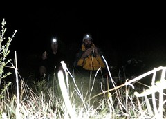
Running down the tunnel of light created by
my headlamp.
my headlamp.
Done in 2:55:19, so perhaps we could have / should have looked a little longer for #62, or diverted #41 and #21. Perhaps next time!
Although we couldn't find #80, neither did several other teams, including the top scoring team. The team that came second did find #80 but said it was well hidden. But with one team finding it none of the teams that tried and failed were awarded the points, including us. Team Ultra Fun was 21 out of 27 teams.
Saturday, November 6, 2010
Great Forest Rogaine
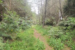
We set a reasonably ambitious route, based on what we should be able to achieve if we were "just" out ultramarathoning. But we were carrying more gear and water than we are used to, Heather was recovering from the Auckland marathon the week before, and I had various excuses! So we followed the initial part of our plan, but then cut a big chunk off later in the day as it became obvious our plan was too ambitious.
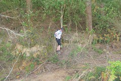
Heather emerges onto the forestry road after
control 72.
control 72.
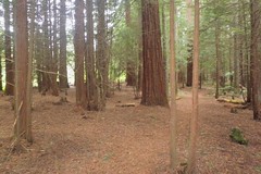
On the way to #68
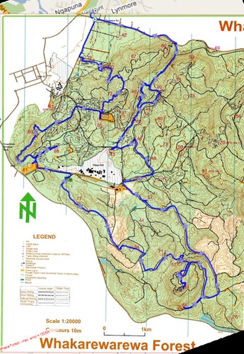
Our route. In most places the layering of the route on the map works well,
although it does go a little astray in the bottom left hand corner.
although it does go a little astray in the bottom left hand corner.
Easy travel along forestry roads to #71 and then some compass work to get to #57. Just when I was starting to get concerned that the undergrowth was becoming significantly more difficult to push through and it seemed to be taking a long time to get to the track, out we popped! Turn right and follow the single track (+ a climb) and there was #57. Follow the single track out to the clearing by the road and time for a stop for food and warmer layers.
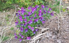
Pansies growing in the old quarry
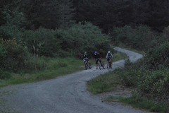
MTB rogainers check their maps as darkness falls.
We got #60 with no problems, but on our way to #90 made a blunder... It seemed to be taking a long time to get to #90, and after checking the map several times I worked out that we had taken a wrong turn. The good news was that this would still get us there, just a little more indirectly. The foot track had been following a stream, and then started to climb away from it. We must be getting close... and then looming up out of the darkness was a huge tree killing machine with enormous pincers and a mass of downed trees strewn behind it. I tried clambering over the trees to see if I could find a way through, but there was nothing obvious. In the end we decided that it would be better to just retrace our steps and take our originally-intended route to #90. So we got there, but not without wasting a lot of time. And it turns out that if we had clambered over the logs we would have found ourselves on the road that leads to #90. It all seems so much less obvious in the dark!
#90 done and all that time wasted it was time to start heading back. Out to the road, we should be able to run along that and pick up #42 on the way. We were jogging along quite nicely until the edge of the road where I was suddenly had a big hole and I tripped. Thump, I went down hard. The map in my right hand protected most of that hand from the coarse chip - the bag shredded, the map was largely ok, and there was a gouge out of one part of my hand. My left hand was saved by my compass, with the cover of the compass shattering on impact. I also took a solid blow to my left knee, and once I stood back up it seemed like I would only be hobbling slowly back to the finish. My leg loosened up a bit as I started to move, and after a couple of minutes I was walking at a reasonable speed. #42 was now out of the question, so it was straight back to the finish and pizza!
More photos available on Flickr.
Sunday, September 26, 2010
Otonga / Belmont Regional Park

A portion of the Otonga map showing my route
I did manage to get lost at one point towards the end. I was heading through the bush towards A20. Having taken a bearing I was heading in generally the right direction. I got to where the bush became more difficult and started to look around. Before long I was not sure which direction I had come from, nor which direction to go. So it was out with the compass and take a bearing back towards the track, which was in the opposite direction to where I thought it would be! Follow the compass and in just 20m or so I found the control. Then it was follow a littl gully up to the track and then off to collect A8.
Tuesday, August 3, 2010
Korokoro Rogaine

I deliberately stayed away from tracks I hadn't done before, enjoying the trip down Gabriel's Gulley (#80, #65) and across Puketirotio (#63, #72).
Managed to miss a critical track junction on the way back, and consequently also missed 100 points (#30, #71). Finished with just 490 points, reflecting the reduced time and my generally tired state from too much work and not enough sleep. After deduction of 10% for being solo I ended up equal last!
Tuesday, July 13, 2010
Rogaining in the Wild West
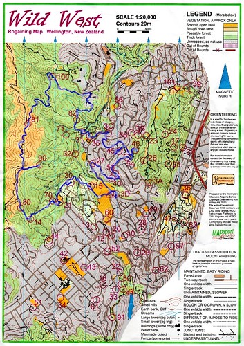
Arriving all of 2 minutes before the start I had no time to plan a route. A quick look at the map suggested controls #15, #30, #21, and #70 might be a good place to start. #15 was a breeze to find, and then as I made my way through the graveyard towards #30 I nearly fell into an old grave! As I was walking along looking at the map I strayed off to the right and walked into the side of an old grave with mid-shin height concrete sides. It just so happened that the concrete top on this one had caved in, so I really could have fallen in!
With a head torch that wasn't as bright as it could be it took a while to find #70 in the bush. After some indecision I decided that up the hill to #14 and #80 would be my next move.
On my way up from control #70 I was caught by Anna McDonnell and Helen McKendry, and from there we stayed together heading over Johnson's Hill (control #80) then ran along the Skyline track to #90 and #81, and down to #100. The night was calm and clear, treating us to spectacular views across Wellington and the harbour.
Coming down from #100 we briefly touched on suburbia before heading into the bush towards #82. Anna and Helen's lights were far superior to mine, enabling them to run much more quickly through the bush. They arrived at #82 ahead of me and then sat down to plan their next move. I had a vague idea of where I was heading next, so I set off for #31, #35, and #3C, joining up with Michael Wood and Gordon Balfour along the way. Michael and Gordon then went off to collect #56.
I pondered my next move and decided on #45. While I was making that decision Anna and Helen reappeared and I joined them again as we trudged up the hill. #45 collected the girls were quickly off to collect #46. I was feeling a bit tired by now and took a while to convince myself that this was a good idea! But eventually I did, and while I was heading in on the bush track the girls were already heading back out. Thanks Anna for the tip on the sidetrack to get to the old quarry, without that tip I would have kept going on the main track and missed it!
Back out on to the road, #54, #53 and #40 were the obvious choice. Time was running down so I then opted for #27 and #3D, with the option of #60 if there was sufficient time. There wasn't, so I finished with 920 points.
Anna and Helen finished on 1110 points, 10th out of 37 teams and 2nd all women team. 920 points would have put me in 20th place, but with a 10% penalty for being solo I dropped to 26th place. Time for prior planning would have been good, as would better lights, but I still might not have been able to match Anna and Helen.
Official report and results are here.
Sunday, May 16, 2010
City Safari 2010
Updated 27 May 2010: copy of map added.
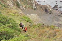 As with previous years the event started with a 10 minute prologue. We didn’t look at the map until given the instruction to start so there was no time to plan a route: it was just start running and look at the map as we go. We went north and collected 1, 20, 10, 11, 12, 13, and 5 from the prologue map.
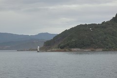 The harbour was calm, so we planned a route that included catching the ferry across to Seatoun. The ferry left 30 minutes after the event start, so after collecting the ferry ticket we collected a few nearby controls: 1E, 28, 27, and 1D. That gave us 60 points and we were back to the ferry with a few minutes to spare.
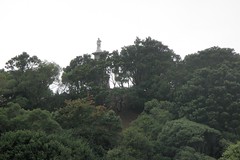
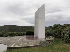 A 20 minute ferry ride across to the Seatoun wharf, and we were at the far side of Seatoun in half the time it would have taken to get there on the bus. Then it was 2N, 1V, 3N, 1W, along a nice trail to 46 and then 2M for a combined total of an extra 130 points. At this point it was decision time: back into central Seatoun or south to the 110 points down by the south coast. We decided to head south and made a start up the ridge track. We very quickly decided that was a bad idea and dropped back down to the road and went around the coast. Up to the Ataturk Memorial for 73, and then round to a “small but rugged hill” by the airport for 45. From there it was through the airport carpark and back into central Seatoun for 3M, 1T, and 2L.
Having just picked up 2L we saw a bus coming towards us and made a split second decision to catch it. It turned out to be heading into the hills of south Seatoun before returning back past the spot where we caught it, and then through to Kilbirnie and past the Hospital.
Getting off the bus just before the hospital we headed across to 3H, 1N, 2G, 3G, 2F, up Todman St (steep) to 41 at the Brooklyn War Memorial. Then 1L, 2D, and 3F the sculpture of a man on a donkey at the National War Memorial. Then through the chaos of central Wellington for another 60 points from 2C, 1J, 2B, and 1H.
Along to the cable car, 30 minutes to go. We debated whether we’d have enough time to go up, get the points at the top. We decided we would go up, and then sat there stressing as first it didn’t move, and then when it finally moved off it travelled at a very sedate speed.
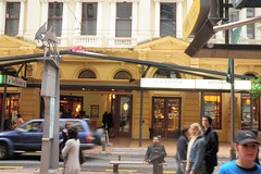 At the top we raced across the carpark to get 29, then down to Salamanca Rd for 1G, then run along a trail down to a motorway overbridge. Down to Plimmer Steps then along to Jervois Quay and the finish with about 12 minutes to spare.
Our final score was 75 from the prologue plus 660 from the main event, for a total of 735. This placed us 13th of 26 mixed teams, and 30th overall of 63 teams.
The Ataturk Memorial
Having just picked up 2L we saw a bus coming towards us and made a split second decision to catch it. It turned out to be heading into the hills of south Seatoun before returning back past the spot where we caught it, and then through to Kilbirnie and past the Hospital.
 Brooklyn War Memorial from the top of Todman Street | 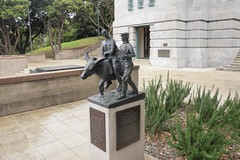 Man on a Donkey, National War Memorial |
Getting off the bus just before the hospital we headed across to 3H, 1N, 2G, 3G, 2F, up Todman St (steep) to 41 at the Brooklyn War Memorial. Then 1L, 2D, and 3F the sculpture of a man on a donkey at the National War Memorial. Then through the chaos of central Wellington for another 60 points from 2C, 1J, 2B, and 1H.
Along to the cable car, 30 minutes to go. We debated whether we’d have enough time to go up, get the points at the top. We decided we would go up, and then sat there stressing as first it didn’t move, and then when it finally moved off it travelled at a very sedate speed.
View of Lambton Quay / the Old Bank Arcade from
the bottom of the Plimmer Steps
the bottom of the Plimmer Steps
Our final score was 75 from the prologue plus 660 from the main event, for a total of 735. This placed us 13th of 26 mixed teams, and 30th overall of 63 teams.
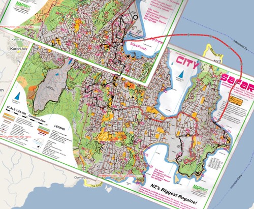
Map showing route taken: red = motorised transport (ferry, bus); black = foot. Map has been warped to fit my mapping software.
Photos available on Flickr.
Sunday, April 18, 2010
Moonshine 24
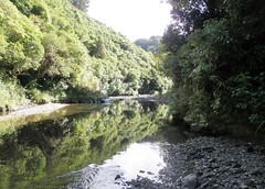
Set off for #10, in the midst of a bunch of people heading up a ridiculously steep track. If this was the effort required to get an easy 10 pointer then this would be a long, hard day!
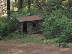
Old hut on the way to #82
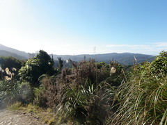
View from the hill tops
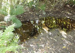
Part of the track between #66 and #68
Around to Orange Hut at the top left of the course, and then along the stream to #87. The route guide directed us to a gully that was relatively easy travel up to #99, but also said that it would be unwise to attempt this section in the dark. It was now 5pm, and the light was definitely starting to fade, but would we have enough time?
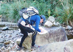
Taking a bearing to the gully
Time for dinner.
Soon after departing #99 we lost the track and had to backtrack and start again. The route guide said that the intermittent track followed an old tramline. We were on a benched formation of some sort and thought we had it right. We were paying more attention to this instruction than to the map, which showed the track heading along the ridge line. We were pushing our way through regrowth, sometimes emerging onto what clearly seemed to be a track, and was definitely benched. But the "track" was dropping lower and lower. Eventually we were so far below the ridgeline that I decided it would be worth climbing back to the top to see if there was a more defined track up there. A steep climb to the ridge, then out with the compass to find that we had been heading in almost the opposite direction to where we should have been! Some compass work and a little bush bashing and we regained the track.
It had been dark for several hours by now, and we were a long way from where we had wanted to be. It was time to shorten our route and keep to the roads and tracks. #37, #22, bypass #67 which was off track, completely avoid the SW corner of the map, and head for #79.
#79 took a while to find, mainly because it was not where the map suggested it would be. We were fortunate to be in the right place as someone else did find it. After that it was a climb to get #60, then a trek back to the campsite to have something to eat and a short sleep.
I woke after about 3 hours sleep. There was no sign of life from Jan, so I set about plotting an alternative route for the morning. Given yesterday's progress the route we had previously planned was wildly optimistic. Having done that it was off to the hash tent to have some breakfast while I waited for Jan to wake.
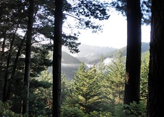
Early morning sun.
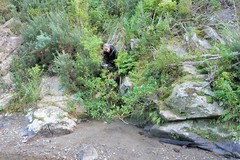
Jan emerges from the scrub onto the bank of the
Whakatiki River
Whakatiki River
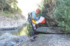
Punching in at #83
We still had a considerable amount of time before the 24 hours was up, but we were tired and couldn't really be bothered with another long steep hill climb, so we decided to return to the finish. We got there to find that we weren't the first to finish, but we were about an hour and a half early.
More photos available on Flickr.
Saturday, December 12, 2009
Christmas Rogaine

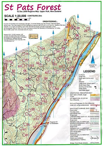
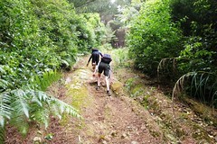
Richard and James on the steep climb to #74.
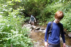
Travelling down the creek after #35.
The results would have been the same even if we had collected the 90 points for #94, as the 13th team had 800 points. Finished in 4h57m30s, so the decision to skip #64 was probably right.
Tuesday, November 17, 2009
Mount Vic "Sprint Rogaine"
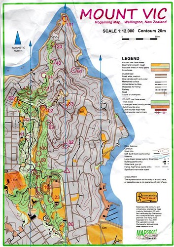
Followed the masses down to 80, then through to 23. Rather than dropping from the road to 103 I elected to climb the steep bank from the velodrome, and was in exactly the right spot. Follow the tracks to 21 and 60. Drop down to the streets and climb the rough track from the bus tunnel up to 100. Up the road a short stretch and down through the maze of tracks to 41. Easy tracks to 62, 43, 22. 81 proved impossible for anyone to find, so everyone who tried for it was credited. Then 40 and 20, and a hunt for 101. The track up to 61 appeared to be slightly further south, but I found it.
Then it was decision time. I had five controls left to get, but time was ticking on. I opted to head back to base via 82, with most of the long stretch from 101 through to base at a jog (but walking the steps for #61). The alternative to collect all controls would have been 83, 102, 42, 63, 82.
A larger version of the map is available here.
Wednesday, July 22, 2009
Brooklyn Rogaine
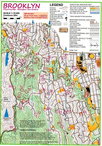
My initial route was 42, 62, 81, 21, 61, 52, 60. Then down a steep track to find 41, but searched for a while and couldn't find it. 31 and 100, but now my achilles was starting to make its presence known. Plan had been to do something like 51, 90, 70, 82, 34, 35, 22, 20. Instead had to set new route to be able to get back to the finish within the time limit while just walking. Back down Holloway Rd and Aro St, back over 52, score on 33, 20 and back to base. Ended up being 15 minutes early with no close by controls to collect.
A larger version of the map is available on Flickr.
Tuesday, May 26, 2009
Southern Bays Rogaine
This was my first rogaine in quite a long time. I ran a reasonable amount of this, but also stuffed around trying to find some of the controls. It appears that I may have taken the long option; I should perhaps have gone west where the hills and closer spacing may have been better suited to me.
6pm-9pm, mainly dark. Temperature was perhaps 8 degrees C, with a few early showers and a cool southerly breeze. Conditions were superb walking/jogging back along Lyall Bay.

6pm-9pm, mainly dark. Temperature was perhaps 8 degrees C, with a few early showers and a cool southerly breeze. Conditions were superb walking/jogging back along Lyall Bay.
Sunday, May 17, 2009
Just Roaming Around: City Safari 2009
An urban rogaine where competitors are able to use public transport. Seemed like a good way to get teenagers out of the house, so I signed us up for the shorter 3 hour option. Scored 235 points on the main event, plus 60 points from the prologue, less 30 points for being late on the prologue, giving a total of 265 points. We placed 14th of about 46 family teams, although some would have had much younger children than our team’s youngest of 11.
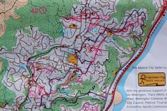
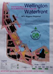
The event started with a short 10 minute prologue. I figured out a route that should have got us back just within 10 minutes. I would have been right too, except for taking the long way to get to one control... so we ended up being a bit over one minute late back to the finish and losing 20 points from our score.
A few minutes to recover and then it was the main event. We made our way down to the railway station via an easy 5 point control. A couple of minutes wait before the train was due to leave, and then a pleasant ride up the Ngaio Gorge to Khandallah.
From Khandallah station it was a short walk through the streets to #21. #42 looked promising, but there would be a fair amount of climb and I wasn’t sure that the boys would be too thrilled with that. So we left that one alone and retraced our steps to Khandallah station, then a shortcut through a walkway and #22. Then along to #12 and a longish walk and partway down a hill to #31. Back up the hill to Cashmere Avenue School. The map suggests that it would be possible to take a shortcut through the school to get to #13, but it looked like we would have to descend into the school grounds then climb a steep walkway on the other side. We decided that it would be easier to just go around the streets and avoid the extra climb.
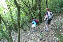 From #13 it was on to #23. From there our plan called for #14 and then #52, but I was getting a little nervous about time and elected to take the direct route to #52. A climb up a steep sealed vehicle track to #52, then down through a nice bush track to #16, then up a hill to #32.
Time was counting down now and it was imperative to catch the train on time. If we caught the train we would finish in time; if not we would be at least 20 minutes late and lose 200 points (or be DQed). We seemed to have enough time so jogged a bit along the road to pick up #15, then a push up to Awarua Street station. Time to recover and have something to eat and drink!
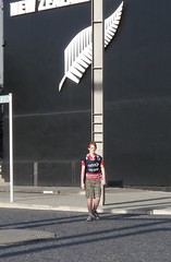 Another pleasant journey back down on the train and plan what to do with the 24 minutes we would have when we got into Wellington. #2E (worth 20 points) at the NZ Rugby Union HQ looked promising, and there was a shortcut along the platform and over the Stadium concourse. We made it down the end of the platform (as did many others on the train) only to find that the gates to the concourse were locked. Back down the platform – minutes wasted – and along the footpath. Wait for the crossing, then across the road and pick up the control.
There was nothing else for us to pick up on the way back, so it was just a matter of a quick walk back. We passed lots of other teams, but already having late penalties from the prologue wanted to be sure that we’d be back before the finish time. Finished in 2h55m, comfortably inside the 3 hours.
Above: portion of the main map showing where we
collected most of our points.
Right: Prologue map.
collected most of our points.
Right: Prologue map.
The event started with a short 10 minute prologue. I figured out a route that should have got us back just within 10 minutes. I would have been right too, except for taking the long way to get to one control... so we ended up being a bit over one minute late back to the finish and losing 20 points from our score.
A few minutes to recover and then it was the main event. We made our way down to the railway station via an easy 5 point control. A couple of minutes wait before the train was due to leave, and then a pleasant ride up the Ngaio Gorge to Khandallah.
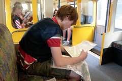 Reviewing where we will go. | 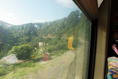 View out the window. The gorge drops very steeply into the bush. |
From Khandallah station it was a short walk through the streets to #21. #42 looked promising, but there would be a fair amount of climb and I wasn’t sure that the boys would be too thrilled with that. So we left that one alone and retraced our steps to Khandallah station, then a shortcut through a walkway and #22. Then along to #12 and a longish walk and partway down a hill to #31. Back up the hill to Cashmere Avenue School. The map suggests that it would be possible to take a shortcut through the school to get to #13, but it looked like we would have to descend into the school grounds then climb a steep walkway on the other side. We decided that it would be easier to just go around the streets and avoid the extra climb.
Time was counting down now and it was imperative to catch the train on time. If we caught the train we would finish in time; if not we would be at least 20 minutes late and lose 200 points (or be DQed). We seemed to have enough time so jogged a bit along the road to pick up #15, then a push up to Awarua Street station. Time to recover and have something to eat and drink!
There was nothing else for us to pick up on the way back, so it was just a matter of a quick walk back. We passed lots of other teams, but already having late penalties from the prologue wanted to be sure that we’d be back before the finish time. Finished in 2h55m, comfortably inside the 3 hours.
More photos available on Flickr.Official event website: www.citysafari.org.nz
Tuesday, June 20, 2006
Mt Vic Shoestring Rogaine
Saturday, February 18, 2006
Tararua 24
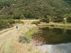
Control #71 was at the southern edge of this pond.
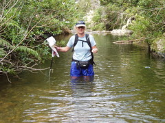
Jan heading up Carrington Creek.
Although we had entered the 12 hour rogaine it was being run as 2 x 6 hours, and the clock was running down to when we needed to be back. We abandoned our plan of heading down to Totara Flats and instead decided to take the more direct route following the old track along the ridge. As soon as it got dark our travel slowed to a crawl as with our low powered lights we had to be very careful to ensure we picked up the track markers. We eventually picked up control #92, and by some miracle control #89 - we were not at all sure that we would have found #89 coming from the other direction. It was back onto the main track after #89, but we were already overdue.
We had a tired climb up to the Mt Holdsworth / Gentle Annie track and then a fast walk all the way down to the start / finish area. We could have looked for #32 on the way down but instead decided that we shouldn't waste any more time and should get back as soon as possible. When we finally made it back we were 4 hours overdue! We had some hot food from the hash tent then retired to the tent for a few hours sleep.
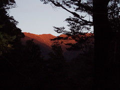
Sunrise on day 2 as we were on our way to #83.
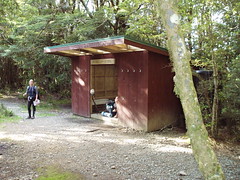
Jan by Mountain House shelter.
Reaching the bottom of the Gentle Annie track we crossed Donnelly Flat and the Atiwhakatu Stream and picked up #55. Back down the track towards the start/finish area we still had plenty of time so we collected #41 from Gentle Annie Creek. There was only 25 minutes left so rather than risking being late again we went back to the finish.
Total points zero for the first day's debacle, and just 350 for our tired wanderings on the second day.
Subscribe to:
Posts (Atom)