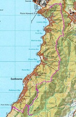
These maps are all generated by some software called "Sport Tracks", which provides very convenient and easy-to-use place to store and analyse workout information recorded on a GPS, and can then plot the recorded route on any map that the user uploads. Sport Tracks is available free from Zone Five Software, although users are encouraged to donate. Sport Tracks has lots of "plugins" which allow it to be customised for individual sports and preferences.
The default maps available on Sport Tracks are those available on Google. The ability to upload custom maps is provided by the "OziExplorer" plugin from a developer called "Old Man Biking". Again the OziExplorer plugin is available free, but regular users are encouraged to donate. I think it's a fantastic little piece of software, so I have donated.
I have organised the discussion into an introduction into some of the basic Sport Tracks information and a closer look at custom maps.
Basic Sport Tracks Information
Activity Summary and Aerial Photo (“Satellite”) View
The screenshot below shows some of the basic workout information that is captured by Sport Tracks. The top panel contains a daily list of activities for the week, and below that is a summary of information from the workout (left) and the route plotted on the google "satellite" map (right). Workout information includes basics such as time and distance (automatically generated from the GPS data), but also user-specfied data such as comments on the workout. Depending on how you want to use the software, under “equipment” you can record the specific bike, tyres, shoes, etc that you were using.Elevation and Options
The screenshot below shows the elevation chart, with the summary of ascent and descent for the selected workout, and a different view of the route (this time using the Google street map). Also shown by the elevation chart is the list of workout-specific information available: an overall summary including user-entered comments, splits, pace, elevation, and three further options that I never use (workout, cadence, and power - the last two being cycling related).Elevation and Pace Chart
A different view this time: just an example of how different charts look. On the left is the pace chart, on the right is the elevation chart included in the previous example. Because I have very little smoothing specified the pace is a bit erratic. When I’ve stopped but left the GPS running I get a big spike (but if I was using speed rather than pace in those places it would just drop to zero). |  |
Custom Maps
Mt Wainui to Battle Hill
The screenshot below shows a partial view of the map for this trip. Part of the map is from a local mountain bike rogaine (the "Akattack" - I purchased the map, but didn’t do the event), and part from an official topo map. The OziExplorer plugin allows you to take a scanned copy of any map, identify 4 points on it, and then the software scales it to fit.I could have selected prettier examples showing a route fitting nicely within a single scanned map, but my existing posts already do that. The examples below show how Sport Tracks allows multiple overlapping maps to be used, so that when one map runs out you can move on to the next. And in this instance my selection of the anchor points was sufficiently good that the tracks run smoothly from one map to the next!
One of the things I like best about the ability to import maps is that the rogaine maps have lots of tracks marked that aren't on topo maps, and which I I didn’t take. Once I've uploaded my route I can see where those other tracks went (but from an aerial photo I can’t). And that suggests possibilities for further exploration...
And here’s another screenshot showing how the workout information can be hidden to get a wider view of the map. This time we have a composite of the Akattack map (where available), a topo map, and the aerial photo. The section between Mt Wainui (the little 3 in a yellow diamond) and the little 4 in a diamond is a marked track, but appears on no maps that I am aware of. The Orienteering people knew it existed, but no one had any idea where it came out. We speculated that it could go either in the direction it does, or south east to point 650. So now we know, and it can be added to future maps.


0 comments:
Post a Comment