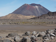
Tongariro's North Crater rises high above the usual tourist route and intriguingly looks to be completely flat. We had been past the crater on many occasions, but until now had never paid it a visit.
Our general route was:
- Up the old Devil's staircase, now no longer marked, to rejoin the standard track at the entrance to South Crater
- Across South Crater to a the foot of a spur that the topo map suggested would provide an alternative route to the east ridge
- Sidle across to the saddle between the east ridge and North Crater, and from there gain access to the crater
- Having circumnavigated the North Crater, drop down across the west face of Tongariro and exit to the Mangatepopo Valley via the stream incorrectly marked on topo maps as being soda springs.
Our intention on this trip was to stay off track as much as possible, although we did take advantage of the Mangatepopo Valley track to speed our travel along the part we had walked many times before.
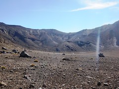
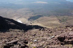
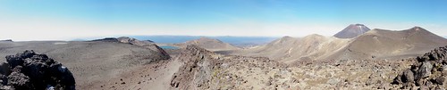
View across South Crater to the
spur we used to access the east ridge
The route up the Devil's Staircase and across South Crater is straighforward. Our objective was a prominent spur to the NNE of the entrance to South Crater. We intended to travel up the gully behind the spur. At the foot of the gully we found a small spring, highlighted by a thick green bed of moss. The route up the gully did not look promising, so instead we crossed back on to the spur and travelled up the side of that. A more direct route would have been NE from the crater entrance and up the gully at the E side of the spur.
Having gained the E ridge we travelled NW to a small saddle, which in turn provided a straightfoward route to sidle around to the wide flat saddle leading to North Crater.
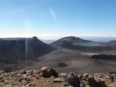
View from the east ridge across to North Crater (left) and the Blue Lake
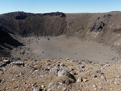
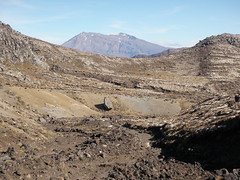
Blast crater with small brown "lake" on the floor
Given that we were approaching the saddle from the E, the plan was to head around the E side of North Crater first, continuing anti-clockwise to complete the circuit. Jan changed her mind when we started to climb the rim and headed W instead. This brought us to the high point on the rim, and it was time to stop for lunch. After lunch we continued around in a clockwise direction, which soon brought us to the edge of the blast crater.
From various points on the main crater there were views across to Lake Rotoaira, down to Ketetahi Hut and the springs, across to Blue Lake and Emerald Lake, and back to Ngaruhoe and Tongariro summit.
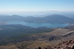 Lake Rotoaira
|  View down to Ketetahi Hot Springs (steam, left) and Ketetahi Hut (centre right) |
 View across the brown "lake" in the main crater with Ngaruhoe behind | 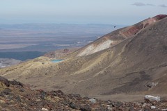 Emerald Lake and side of Red Crater |
The upper reaches of the Wanganui River Valley,
with just one small ridge between us and the descent
into the Mangatepopo Valley
Completing the circuit of North Crater we headed diagonally down across the face on the W side of the saddle. We dropped into the Wanganui River valley, then climbed a small ridge to look down into the Mangatepopo Valley. Our plan from here was to follow the dry stream bed down. This was intially reasonably straighforward, but hit a snag when we came across a very high dry waterfall (perhaps 20m), at which point we switched to the true left bank. A short distance further and even that seemed to become precipitous so I scouted ahead to find a route that would be more to Jan's liking. My first attempt ended in a vertical section, but the second attempt was more successful. We made our way down the spur to the true left of the stream bed and then picked up the main Mangatepopo Valley track back to the carpark.
More photos, and larger sizes, available on
Flickr.
0 comments:
Post a Comment