Introduction

Welcome to my blog. The title originates when my primary athletic activity was competitive walking, but now that I am back to running it also includes that.

Not all content is accessible from the main page: for example, the rogaines, racewalking, and ultramarathon pages all include content that is only accessible from those pages.

Ultramarathons

Ultramarathons are any event longer than the standard marathon distance of 26.2 miles / 42.195km. Standard distances for ultras are 50km, 50 miles, 100km, and 100 miles. There are also 12 hour and 24 hour track runs, and multi-day "stage races".

I have currently (September 2012) completed 30 ultramarathons, plus 1 DNF at about 66km at the Molesworth Run. Reports for most events are provided below.

See also

Rogaines

Rogaining is the sport of long distance cross-country navigation. Events can be as short as 2-3 hours or the standard 24 hours. Teamwork, endurance, competition and an appreciation for the natural environment are features of the sport. Rogaining involves both route planning and navigation between checkpoints using a variety of map types.

GN Phillips and RJ Phillips, Rogaining, 3rd ed, 2000


The two main umbrella organisations for rogaining in New Zealand are: My reports for selected events are provided below.


Hiking and Mountains

The Hiking, Trail Running, and Mountains pages are all inter-related, but with some subtle differences:
  • Hiking is not an organised race, and may include Coastal Adventures, activities in the Mountains, and hiking in other locations;
  • Trail Running covers organised events, some in the mountains, but others on local hills and trails; and
  • The Mountains category covers both events and hiking in various places that can be classed as mountains.


  • Racewalking

    Racewalking only has to meet two technical requirements:
    • no loss of contact, as judged by the human eye; and
    • the leg has to be straight from the moment of first contact until it is upright.
    More detailed rules are here.

    I'm not particularly good at racewalking, often falling foul of the straight leg rule. But I still give it a go and here are the results of my endeavours.


    Running

    This blog is primarily about my walking activities, but sometimes I do run. Here are reports for events where I have run.

    Shorter Races

    I classify events as ultramarathons, marathons, rogaines, and "shorter events". So a "shorter event" is just something that is shorter than a marathon and is not a rogaine. Consequently there's a mixed bag in here: running, racewalking, half marathons, 10k and 5k races, , etc.


    Showing posts with label Training. Show all posts
    Showing posts with label Training. Show all posts

    Sunday, March 2, 2014

    Cannon Point: The Wild Side

    Dragon fly near the stream. For scale, my fingers
    are touching the wing.
    Being right on the edge of town, Cannon Point has some very civilised tracks. But for those who know where to go there are also some wilder seldom-visited trails. This was my last training hit out before the Tararua Mountain Race, and I wanted to make sure that I had some hills, a bit of rough trail, and a bit of route finding. So the general plan was:
    • down to the Whakatiki River (easy gravel),
    • up to the trig (initial steep climb on MTB trail, 4WD dirt and gravel, rough route through bush, easy MTB),
    • down the road to the back of the dam (easy gravel),
    • follow the stream to the dam (no track, route finding),
    • back to the start (easy trails).

    Below are a few photos from the journey.
    So nice of the council to issue a written invitation.
    And this is the sole reason that the track was closed.

    Blackberries
    After the 4WD track, the rough route through the bush.

    The trig in the distance.
    The road down to the stream.

    The route ahead - there's even a stream in there.
    Look carefully in the centre of the picture to see a
    fish. There were a lot of small fish that would scatter
    and splash through the shallows every time I crossed
    the stream. I even saw a couple of small trout,
    perhaps 6-9 inches long.

    More of the route ahead.
    Back on to a track, not long before the dam.

    Back at Birchville Dam... and civilisation.

    Wednesday, February 5, 2014

    Waihohonu Hut

    A quick jog into Waihohonu Hut and back to break up a long car journey. This trail has been written about before - and with nothing of particular note I shall just post a few photos.


    Saturday, January 12, 2013

    Waitakere Running, Day #1


    Up in the Waitakere's for a weekend of running for Heather's birthday. Last year we were here for a Running Wild training camp; that was so much fun we thought we'd come back and do it all again on a private basis.

    Staying at Karekare, down the beach to Whatipu, then up the Omanawanui track and over past the trig. Heather, Paul, and I called it quits at this point for various reasons. For me, I'd been having a lot of trouble with both achilles, and they were feeling pretty tight and sore by now. I still wanted to be able to head out for a run tomorrow!

    The group
    Rock formations on the northern side of the entrance
    to Manukau Harbour


    Lake at Tunnel Point
    View from Omanawanui Trig


    Heather at the trig
    Name plate for A9RC

    Friday, November 30, 2012

    Te Miro MTB Park

    Lake at Te Miro
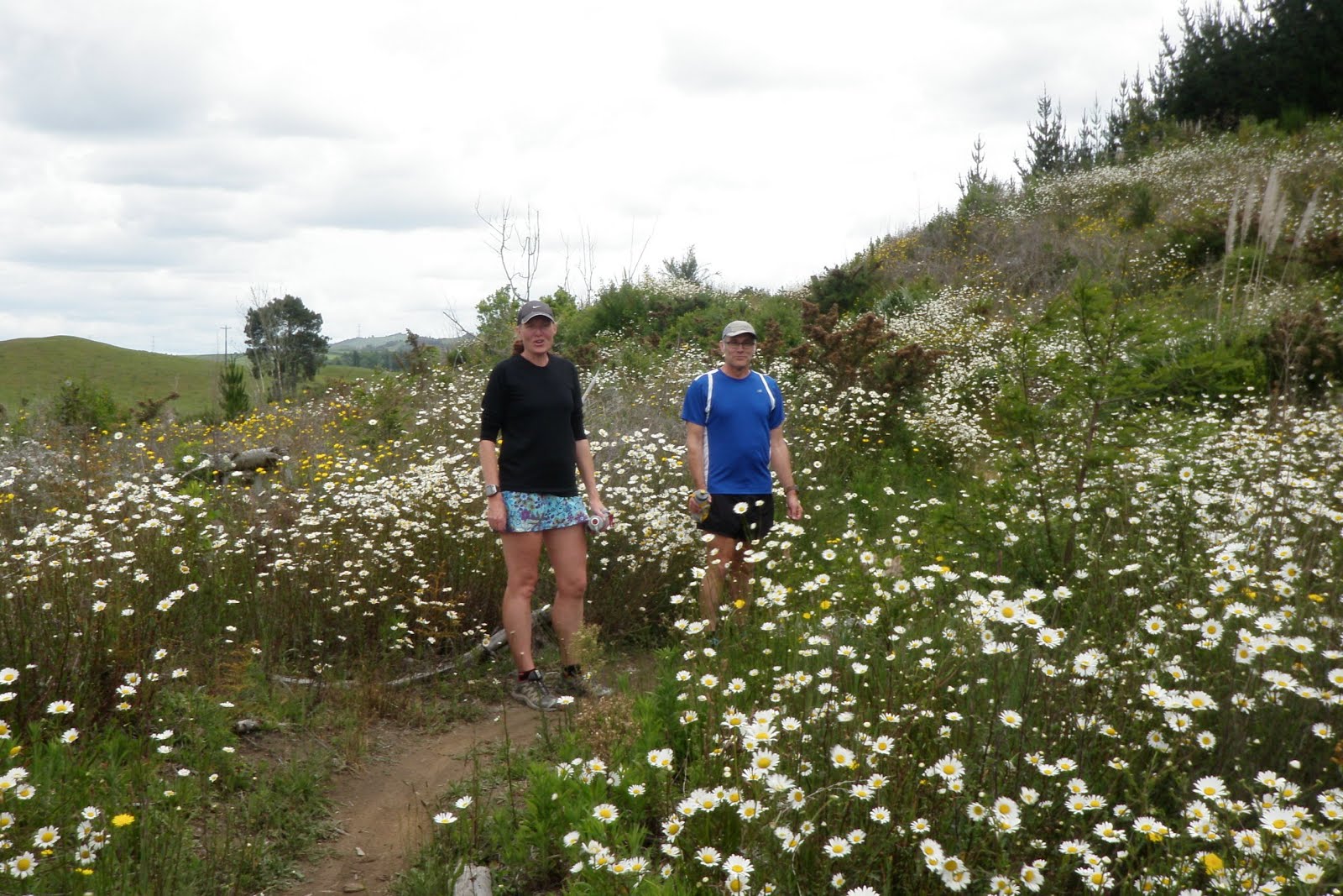
    Had a very interesting session with Sports Psychologist David Galbraith this morning, then met up with Brian Prescott for a run at the Te Miro MTB Park. A spectacular late-spring day with hillsides full of wild daisies!

    Brian tool us on a tour around park, avoiding the downhill area, but taking in the major climb on the "Gloworm" track. In the tradition of all MTB tracks there was lots of twisty windy switchbacks, making the climbs easier and getting as many km as possible out of a limited area.

    Here's a selection of photos from the run:

    At the main carpark: daisies and fresh spring growth
    Stream at the bottom of "PD" track

    Field of daisies
    Heather and Brian

    In the bush
    All in Salomon XA 3D Ultra shoes!

    Derelict shed at the bottom of "Dam Rd"
    Tall timber

    Back to the main carpark

    Saturday, November 3, 2012

    Maungatautiri Block

    Relaxed and ready to start.
    Brian said he'd like to go for a run around the block... seems fair enough, people go for a run around the block all the time. There's just one thing though... his block is 72km around Mt Maungatautiri. Invitations went out, and all the trail runners declined because road would be too hard on their bodies! So that left Brian, me, Heather, and a couple of maybes.

    At the time 72km sounded like a good plan, but by the time the day rolled around I was a bit more realistic and thought 50km was a bit more likely. With a car full of food and drink we headed over the hill to Brian's, and were ready for an 8am start.

    We started off well, with the first 10km ticking over comfortably under an hour. For about the first 16km we shared the road with cyclists competing in a half iron man. It was funny to watch the looks on their faces - while we were close to the start they couldn't care less, but the further out we got the more respect we seemed to get - particularly when they saw us for the second time on their loop.

    At around about 18km I got to talk turkey. There was a group of about 6 or so turkeys in a driveway, with tails all fanned out, gobbling away as we approached. They stopped gobbling, so I gobbled back at them and they all started up again. This happened about three times before we were out of range. Meanwhile, Heather was still a couple of km back with the car, talking to a coach of some of the iron man athletes.

    But it turned out that no long runs in the 6 weeks or so since Marton-Wanganui was not really the best training regime, and by 20km I was starting to suffer. It was getting hot on the road, and my legs were taking a pounding on the roads. At 22.3km I pulled the pin and sent Heather out to run for a bit. I sat in the car with the airconditioning on full to try and cool down, and drove another couple of km up the road to provide the next aid stop.

    The promise of the open road
    Brian and Heather
    After about 7km it was time for me to get back on the road. I had cooled down, and the humidity also seemed to have cleared. Cloud was building as the forecast rain was visible in the distance.

    A nice stretch of downhill.
    At one point a paddock of cows was very interested in Brian and me: they would run along in their paddock until just ahead of us then turn to face us and watch us pass, before running ahead and doing it all again. Their game was up when we turned a 90 degree bend heading directly away from them and started down a very long straight road that disappeared into the distance. The road was at least 3km long, then dropped down into a fairly significant valley before climbing out the other side. My untrained legs were really suffering from all the downhills, and this time I stopped after about 20.7km.

    Heather took over for about 10km or so, and it really started to pour. She started off with her raincoat, but it was warm and she got so wet that she decided just to run in a long sleeve top.

    By the time Heather had finished, so had the rain. I was back on the road for the last few stretches of downhill to Lake Karapiro, and then on to the finish. Some rowing races were in progres as we ran past, although both Brian and I were walking all the hills. The last couple of km were dead flat, on a concrete footpath. Ordinarily I would hate concrete, but my legs were sufficiently sore that it made no difference!

    All up I did 22.3 + 20.7 + 12.4 = 55.4km. Not really an ultra because it wasn't continuous, but a good training run and a good way to spend the day.

    Sunday, October 28, 2012

    New Track: Maidstone Ridge

    On today's run I was intending to search for a trig, but instead found a new track. At the top of Seymour Grove is the Maidstone Ridge track, heading generally SW. But at the top of the road I spied what looked like a bit of a track heading NE between some vegetation and around the side of a low hill... so I followed it... and indeed it was a track! Properly benched, orange triangles for markers, through a mixture of bush and open grassland. This was a great find, just a pity it is currently a dead end!

    View through the bush section
    Route map

    Orange marker on the fence and new stile
    Through the bush

    Sunday, July 22, 2012

    Cannon Point "New Route" Again

    Elevation Profile
    Almost identical route to last time, just a different trail choice on the little terrace. 39s slower to the Trig, and slower on the way down and back home. 1h:06:14.

    The chart on the right shows the elevation profile for the route. A good solid climb, and I haven't been able to run it all yet!

    Monday, July 2, 2012

    Cannon Point "New" Route

    Cannon Point Trig
    Not really "new" as the tracks used have been there for quite some time, and most of them I have done at some point or other. But this was the first time I strung them together in this order to go up and over Cannon Point.

    Took the Regional Council's upgraded track on the True Right of the Hutt River down towards the Whakatiki River. Thankfully they haven't upgraded the whole track, and once it gets into the bush it is still an undulating muddy delight! From the Whakatiki River it is up a small zig-zag to gain the terrace where a house must have once been. Last time I went up here there was no track, and this looks like the work of a private citizen, perhaps a mountain biker.

    Pick one of three tracks ... I seemed to pick the "adventure option", clambering over a few fall trees, then out to Three Skulls Rd. A few hundred metres of sealed road, then turn right onto the clay pylon access road. This road is not marked on topo maps, but has been in existence for many years. That said, this is the first time that I have used this road. Follow that road up until it eventually ends in a T intersection with a gravel road.

    Straight across the intersection and jump the ditch so a shirt scramble up into the bush. This is one of my favourite tracks - rooty and gnarly and poorly marked (i.e., not at all). That track exits out on to the clay MTB/walking track that leads up to the Trig. From there it was a cruise down the zig zag track to the carpark and then run the streets to home. 1h:04:55.

    Monday, April 23, 2012

    Mangatepopo Valley

    A quick(ish) run 5km up the Mangatepopo Valley and then back to the carpark. Would have been nice to go further, but this was all that was realistically possible. And in any event it's always a great way to break up a car journey!

    Sunday, April 1, 2012

    Deadwood and Blackberries

    Went for a run up the Karapoti Gorge today. Rather than turning at McGhee's Bridge we continued on the forestry road around towards Deadwood. This is part of the main Karapoti mountainbike loop, but it appears that it attracts very little traffic. Or at least very little traffic that is interested in stopping to sample the wild blacberries. There were several large areas of blackberries, and they were all very large and very tasty! What to do but stop for a mid-run snack!!

    After the gentle climb up the gorge and the near flat section through to the Pram Track/Deadwood junction, the Deadwood track has plenty of hills. They were all short though, and at this time of the year it is a beautiful place to run.

    Saturday, January 7, 2012

    Baring Head

    View from the old World War II bunkers
    After a solid day of work it was off to explore Wellington's newest regional park at Baring Head. The park is the home to old World War II observation bunkers, and also to the Baring Head lighthouse which was first operated on 18 June 1935. Some nice trails on open farmland, with great views out into Cook Strait and the western Pacific Ocean.
    The Old Pumphouse
    Our trail guides for the day
    The trail
    At Para Trig
    Baring Head lighthouse
    Baring Head, rocks popular with local climbers