Introduction

Welcome to my blog. The title originates when my primary athletic activity was competitive walking, but now that I am back to running it also includes that.

Not all content is accessible from the main page: for example, the rogaines, racewalking, and ultramarathon pages all include content that is only accessible from those pages.

Ultramarathons

Ultramarathons are any event longer than the standard marathon distance of 26.2 miles / 42.195km. Standard distances for ultras are 50km, 50 miles, 100km, and 100 miles. There are also 12 hour and 24 hour track runs, and multi-day "stage races".

I have currently (September 2012) completed 30 ultramarathons, plus 1 DNF at about 66km at the Molesworth Run. Reports for most events are provided below.

See also

Rogaines

Rogaining is the sport of long distance cross-country navigation. Events can be as short as 2-3 hours or the standard 24 hours. Teamwork, endurance, competition and an appreciation for the natural environment are features of the sport. Rogaining involves both route planning and navigation between checkpoints using a variety of map types.

GN Phillips and RJ Phillips, Rogaining, 3rd ed, 2000


The two main umbrella organisations for rogaining in New Zealand are: My reports for selected events are provided below.


Hiking and Mountains

The Hiking, Trail Running, and Mountains pages are all inter-related, but with some subtle differences:
  • Hiking is not an organised race, and may include Coastal Adventures, activities in the Mountains, and hiking in other locations;
  • Trail Running covers organised events, some in the mountains, but others on local hills and trails; and
  • The Mountains category covers both events and hiking in various places that can be classed as mountains.


  • Racewalking

    Racewalking only has to meet two technical requirements:
    • no loss of contact, as judged by the human eye; and
    • the leg has to be straight from the moment of first contact until it is upright.
    More detailed rules are here.

    I'm not particularly good at racewalking, often falling foul of the straight leg rule. But I still give it a go and here are the results of my endeavours.


    Running

    This blog is primarily about my walking activities, but sometimes I do run. Here are reports for events where I have run.

    Shorter Races

    I classify events as ultramarathons, marathons, rogaines, and "shorter events". So a "shorter event" is just something that is shorter than a marathon and is not a rogaine. Consequently there's a mixed bag in here: running, racewalking, half marathons, 10k and 5k races, , etc.


    Showing posts with label Tararua Ranges. Show all posts
    Showing posts with label Tararua Ranges. Show all posts

    Saturday, March 8, 2014

    TMR: Kaitoke-Holdsworth

    The Tararua Mountain Race ventured into controversy this year by daring to try a different course – the plan being that the traditional course from Kaitoke to Otaki Forks across the tops (i.e. the Southern Crossing) would still be employed on odd numbered years, but on even years a different course through the Tararuas would be trialled. This bold new plan was intended to attract new entrants to one of New Zealand’s oldest and longest running mountain events (not to mention the toughest event).

    2014 this bold new plan was put into action, with the race staged across the rugged Kaitoke-Holdsworth route. Some of the traditionalists grumbled and moaned, with early entries very low. But a week to 10 days out from the event there was a surge in entries (almost doubling), and the race was on.

    The race starts with almost 80m (maybe only 50m) across grass before plunging into bush and the first climb. A bit of a rude shock at 7am, but before long one is out onto more runnable track gently climbing to the Puffer Saddle.

    Track across the first slip
     
    Following Smiths Creek down the other side the track is at times steep, rutted, and rocky, and at other times gentle, smooth, and fast. At the bottom of the descent the first (very welcome) surprise… course markings directed us away from DOC’s alternative route up and around some slips (now a few years old), and instead along the well-padded tracks across the slips. Excellent decision – the alternative route is very steep, rooty, slippery, and a lot more dangerous.

    The only stream with a guide wire.
    This runner also appears in my finish photo...
    First check point is Smiths Creek Shelter and then it is up the Tauherenikau River to Tutuwai Hut. Lots of good running along here, so long as you don’t mind the odd roots, rocks, and stream crossing. Excellent water supplies were provided on course – every time we cross a side stream the water is crystal clear and drinkable.

    Tutuwai Hut itself is off the main track and up in the bush, so the SAR team marshalling at this location have come down to the track. A quick check in and time to go again. Still heading up the Tauherenikau River, this time towards Cone Hut. I wasn’t 100% sure of the track here so stopped to get my map out and was passed by a team of two girls… right track, a bit of a climb and up to Cone Hut. Cone Hut is an “iconic” backcountry hut dating from 1946.

    Running in to Cone Hut
    At Cone Hut

    Marshalls / SAR Team on top of Cone Saddle
    We’re now about halfway in distance, but the climb is about to begin in earnest. This is a fairly steep climb with lots of roots. There’s a couple of trees down, but nothing too much of a problem. Top out and there’s the next SAR team and lots of tape and signs making sure we don’t go the wrong way. The navigation is easy! Down the other side… get to a stream… looks like the track goes across… over I go.. nope, no track. Clamber over a fallen tree… maybe it’s here… nope, slip, crush left calf between right leg and fallen tree. Head back towards the stream and none other than Jean Beaumont makes the same navigational call, she heads to where I’ve just been. I find the track marker… down the stream… let Jean know, and soon she’s caught me up and passed again.

    Some good Tararua running here (downhill with roots), but soon another runner catches and passes me. He’s gone… until I get to the next stream. There’s a really BIG orange triangle on this side and… nothing on the other side. The other runner is searching in the obvious place, and I briefly join him there too. Not there, so back to the marker… ah, there’s the track, hidden by vegetation and heading in exactly the opposite direction. A couple of ribbons on the far bank indicated the exit point, and a few metres beyond that the track became obvious.

    Climbing again, up another hill the same height as what we had just descended. A big downhill down the other side, descending to the Waiohine River valley. A slip and a fall on a tree root down here, but nothing serious. Down to the flats and the immediate potential to go wrong again… the natural lie of the land draws runners right towards the river, whereas the track goes left and across a new bridge. One of the leading teams went astray here and I did my last good dead for the day calling them back to the bridge.
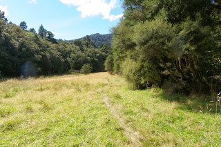
    Totara Flats
     
     
    Along the track towards Totara Flats, this should be easy. Lots of little ups and downs, twisting, weaving, and then ouch… I ground my right ankle against a rock. Hobble and walk for a bit, but I’m getting pretty tired now anyway. The flats might be flat, but the running isn’t great… even the pretty grassy flats have lots of rocks in the trail. Eventually check in at Totara Flats Hut, with just around 11km to go. The problem is that the last 5km is a big downhill, and there is still 1,000m of climb to go.

    Near the top of the last climb. Centre photo is a team,
    providing perspective to just how steep this climb is.
    Over the swing bridge and in to the first climb. My legs are toast now and this is a long, slow plod for me. Eventually top out from that climb and it’s runnable again. A short downhill to meet the old track, and then it’s the most horrendous climb of the day. Rooty, and at 30% very, very steep. Another slow plod and I eventually top out at the groomed Mt Holdsworth track. 5km to the finish, yahe! Time to run again! My legs are pretty fatigued though, so there’s still a few walk breaks down here.

    The Finish. The guy just behind me
    is the same one crossing the stream
    ahead of me in the earlier photo.
    Hit the flats, 1.2km to go, and the legs suddenly feel like lead. Still, how much of this can I run? I pick off one runner who I had last seen much earlier in the day, and then spot another just ahead. This is the same guy I was running up the Tauherenikau River with prior to Tutuwai. I fall in behind him on the final bridge across the Atiwhakatu, and then blast past in a finishing sprint.

    My time is nothing flash, but that’s 40km and 2,000m of ascent done in a much faster time than my original time (the winners are perhaps 10 mins faster on this course), and I had not really trained for anything much longer than 17-20km. Definitely happy with that!

    Tuesday, January 3, 2012

    Jumbo-Holdsworth

    Holdsworth Trig
    At Holdsworth Trig
    My first trail for 2012, and also my first time doing the loop in this direction. The first leg up the Atiwhakatu River track to Atiwhakatu Hut was quite pleasant, runnable in most places, and at 7.3km a wee bit longer than DOC's posted 5.5km.

    OLYMPUS DIGITAL CAMERA
    View of the Atiwhakatu River through the trees
    OLYMPUS DIGITAL CAMERA
    Atiwhakatu Hut

    From Atiwhakatu it was up the rain guage spur track to Jumbo Hut. This seemed to be even worse going up than going down. After an age of slowly making our way up the steep rooty climb we emerged from the bush into the clouds just a little short of Jumbo Hut.

    A short stop for food and to change into dry tops then it was off to Jumbo Summit. Most of this was in the clouds, although visibility was still reasonable and they added dramatic effect to some scenes.

    OLYMPUS DIGITAL CAMERA
    At Jumbo, the ridge to Holdsworth behind
    Just short of Jumbo Summit we broke through the clouds, and from the summit were treated to spectacular views along to Angle Knob, down into Mid Waiohine, and along the ridge to Mt Holdsworth. The Jumbo-Holdsworth ridge was particularly spectacular, with cloud on the eastern side of the ridge and clear skies on the western side.

    After photos we set off along the ridge. As always the climbs and apparently narrow sections looked a lot worse than they actually were. I must be getting old or out of practice though, as very little of this actually seemed to be runnable.

    OLYMPUS DIGITAL CAMERA
    Holdsworth Trig from the sign
    Once at Holdsworth it was time to stop at the trig for more photos. I have passed the trig on many occasions, but never made the very short detour! Cloud would come and go, sometimes obscuring the view and sometimes allowing us a clear view of the ridge we had just travelled.
    OLYMPUS DIGITAL CAMERA
    Powell Hut
    Powell Hut emerges from the cloud

    All climbing done, it was time to head down to Powell Hut. Most of this section of track was very pleasant and easy, and before long the hut suddenly emerged from the cloud. A quick stop to fill in the log book and replenish water, then it was downhill again. Heading down from Powell there are some big drops, much easier to climb up than scramble down, and then there is the steep section of track that heads down to Mountain House. From there it is all straightforward - across Pig Flat and down the Gentle Annie to the carpark.

    We had started relatively late in the day, so it was now time to find some food. Mid-way takeaways in Carterton did not disappoint - not only were they open on a public holiday, but their Hawaiian Burgers were excellent!

    Saturday, December 17, 2011

    Old Dobson's Hut - Smith's Creek Loop

    My last significant trail run for the year, a cool overcast and slightly damp day to introduce Heather to some real Tararua tracks. After a couple of days of heavy rain the track up the Marchant Ridge seemed a little wetter than normal, with fewer branches to provide firm footing through the bogs. A great day to be out though, with no serious rain and good views.

    Link: My Wild Trails Route Guide

    In the bush on Marchant Ridge
    Climbing again, but in the open, after Old Dobson's
    Hut site
    A large tree fall on part of the downhill track
    Trail Runners were here
    Trail Runners were here!

    Monday, December 27, 2010

    Field Hut and Table Top

    Field Hut
    Soon after arrival at Field Hut
    As part of a decent week of training over the Christmas - New Year period, a hike up to Field Hut and Table Top with Richard Wall, Vivian Cheng, and Heather Andrews.

    The DOC sign says 6.6km and 3-4 hours to Field Hut. We made it in a relatively comfortable 2 hours. It had been raining lightly on the way up, but was very warm. We stopped at the hut for lunch, put on some extra layers, and then went on up to Tabletop. It was a bit windier up on the tops and visibility wasn't great, but it was still relatively warm.

    After a bit of larking about for photos at the far end of Tabletop we turned to head back down to the hut. It was definitely colder as we were walking into the wind, and I was now glad to have my coat on. The cloud started to lift as we were descending and soon we were treated with views through the clouds down to Otaki Forks.

    PC270164
    In the clouds on the boardwalk on Tabletop.
    PC270181
    On the way back down from Tabletop the clouds
    lifted to give us this view back down to Otaki Forks.

    Testing the waters
    Viv, Heather, and Richard try to work out whether
    they will cross the river. I already had -- it wasn't
    particularly deep.
    A quick stop at the hut to collect water and talk to some of the other trampers, and then it was back down to the Forks and the car. Conditions were warm and pleasant when we got down there, so we sat on the grass to talk while we ate the remainder of our supplies.

    Saturday, September 26, 2009

    Field Hut / Table Top / Dennan

    An early spring storm blew through on Thursday, leaving behind a reasonable quantity of snow on the ranges. I entertained the thought of heading up alone on Friday, but Jan suggested we both go up on Saturday.

    It was a reasonably relaxed start with us not leaving the car at Otaki Forks until about 9:20am. No speed records were set on this one, but we made our way steadily up to Field Hut. Once there we stopped for our first lunch and put on some dry base layers for heading up to the tops.

    Snowball 4P9260055
    The first remnants of snow were encountered as we neared Table Top. We stopped and tried some posed snowball throwing shots. Then it was a bit further on to Table Top and more posed photos.

    P9260079P9260078

    Otaki River
    The main range looked spectacular, although it too only had remnants of snow remaining. We pushed on up to Dennan - it looks like a steep and gnarly climb from Table Top, but in reality is quite reasonable.

    Then it was back down to Field Hut where we stopped for a second lunch. Then back on down to the car. Very pleasant in the afternoon sun, only spoiled by recent work on the track that had changed it from a track to a gravelled footpath.


    Dennan Map
    Photos available on Flickr.

    Thursday, July 9, 2009

    The New Atiwhakatu Hut

    A mid-week overnight tramp into the new Atiwhakatu Hut with Richard and James.  Although we had camped in a tent before, this was the boys' first overnight in a hut.

    The hut was very nice and new, having only been open for about a month. Although a bit cold and damp outside the hut remained pleasantly warm.  There was lots of potential firewood outside, but most in large blocks that would require a chainsaw to cut.

    The new toilet had not been installed yet.

    In the month that it had been open the hut had seen many visitors, including a party earlier in the week.  A couple of runners stopped in to check out the hut in the evening, but we were the only people staying that night.

    On the walk out Richard and James initially raced off ahead, but James stopped for a drink after 2km. From there on we walked together.  We met Richard briefly at E Holdsworth turnoff but then didn't see him until back at the car.

    Ready to leave in the morning.
    Atiwhakatu River

    Saturday, June 20, 2009

    Powell Hut in Mid Winter

    This was originally planned as a trip up to Mt Holdsworth in the snow, blizzard conditions meant the sensible option was to only go as far as Powell Hut.

    P6200104
    Pig Flat boardwalk
     
     
    Just light snow on Pig Flat, but it looked like there must have been a considerable amount more earlier in the week. Stopped at Mountain House for a snack and to prepare for the upward journey. Fully provisioned just in case things didn't go to plan, my pack was somewhat heavier than normal for a day trip and it was good to have a break. Given the conditions I had decided to take a sleeping bag, billy, gas burner, change of clothes, and extra food. Some of that could be left behind in the summer, but not with the expected heavy snow.

    Mountain House is followed by a slight descent and then the track starts to climb at a significantly greater gradient. The was some snow on the ground, but still relatively little due to the trees.

    P6200109
    There was a dramatic change as we left the tree line: suddenly the snow was deep and it was snowing with a very strong wind was blowing sharp, sugary snow into our faces. It was easy to get very cold very quickly up here, and we plugged on towards the hut. Two faster trampers headed up past us, and a group that had stayed the night at the hut came down with a dog.

    P6200114P6200117
    P6200120P6200122

    When we got to the hut it was time to boil the billy, eat some lunch, and have a hot cup of soup. Dry clothes were also the order of the day. A trip up to the summit was off as the conditions were just too treacherous.

    P6200129
    Heading back down was fun. It was easy to slip over on some of the steeper parts, and at one stage I fell and then glissaded some 50m down the track.

    Before long we were back in the trees and on our way down. Another stop at Mountain House and a quick visit to the lookout. The peaks were shrouded in cloud, with little hint of how bad the conditions were up there.

    P6200143


    Map

    Map

    Photos available on Flickr.

    Saturday, February 28, 2009

    A Damp Day on the Atiwhakatu Track

    Camp
    I was sitting under a tarpaulin eating my breakfast at 6:15am when the rain started. I thought it must just be a shower, but instead it set in and was quite heavy by the time I had packed everything up and was ready to go. Figured that the side creeks could become a problem if there was too much heavy rain, so I modified my intended route and ended up doing the Hooper Loop with some extras.

    P2280010
    Up to Atiwhakatu Hut in 1h15 (DOC time 3hrs). Took some photos, enjoyed the opportunity to get out of the wet, and pondered my next move. Decided to head back down to the Hooper Loop turn off, and climbed up that track to the Gentle Annie. Got very wet and a bit cold as I gained height. At the top decided I needed to put on a dry top, so went along to the Mountain House shelter to do that. And from there back to the top of the climb and back down the Gentle Annie to complete the Hooper Loop.

    Total day was 19.5km in 3h30 of walk time.

    Map
    These photos and more are available on Flickr.

    Saturday, February 14, 2009

    Field Hut and Table Top

    P2140031
    View of Table Top
    Up from Otaki Forks to Field Hut and on to Table Top. 1200m climb over 8.65km (x 2 for return), so a fairly steep one. DOC time was 3-4 hrs to Field Hut; 2 hrs back down. I took 1h41 to the hut, had a photo stop, then went on for 30 mins to reach the Penn Creek turnoff at the far end of Table Top. Total time 4h10 including 17 mins of stops.

    P2140018
    Overnight camp
    P2140030
     

    More photos available on Flickr.